Some of the trails in Great Smoky Mountains National Park are known as “connector trails”, paths that are tucked away and connect multiple trails to each other. So while these types of hikes aren’t as popular by themselves, using connector trails is a great way to spend an entire day exploring multiple hikes in one area of the park. The Hatcher Mountain Trail is one of the great connector trails, so read on to learn more about this beautiful hike in Cades Cove!
| Trail Length | 2.8 Miles |
| Trail Difficulty | Challenging |
| Trail Highlights | Mountain Views, Wildflowers |
Directions to Trailhead
The Hatcher Mountain Trail is located in Cades Cove, one of the most popular places in the Smokies, but you won’t find the trailhead along the loop road. Instead, you’ll have a couple of options. One way to get to the trail is by starting at the Abrams Creek Campground, located approximately a half-mile past the Abrams Creek Ranger Station. Once there, hikers will need to take the Cooper Road trailhead and walk about 4.9 miles before reaching the Hatcher Mountain Trail.
The Cooper Road Trail is also accessible from the Cades Cove Loop Road. You’ll find the trailhead and small parking area between the Missionary Baptist Church and the Elijah Oliver Place. (A quick side trip to walk around the cabin allows you to see one of the old homesteads up close!) Keep in mind that Cades Cove has Vehicle-Free Wednesday every week during the summer, so be sure to plan accordingly and remember to get a parking tag for your vehicle before heading out, regardless of where you park.
Trail Description
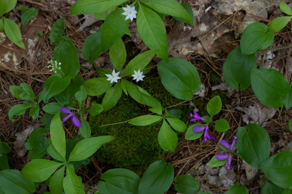
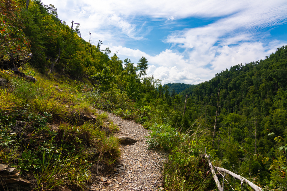
Even though the Hatcher Mountain Trail is less than 3 miles long and fairly easy in difficulty, it’s considered a challenging route because you have to hike several miles in order to even reach this connector trail. But the views are worth the extra time it takes to take the route to Hatcher Mountain, because it’s packed with gorgeous scenery. In the warmer months, walk in the shade of the tall oak trees and look for patches of fringed polygala. They are easy to spot because the flower is a vibrant purple color.
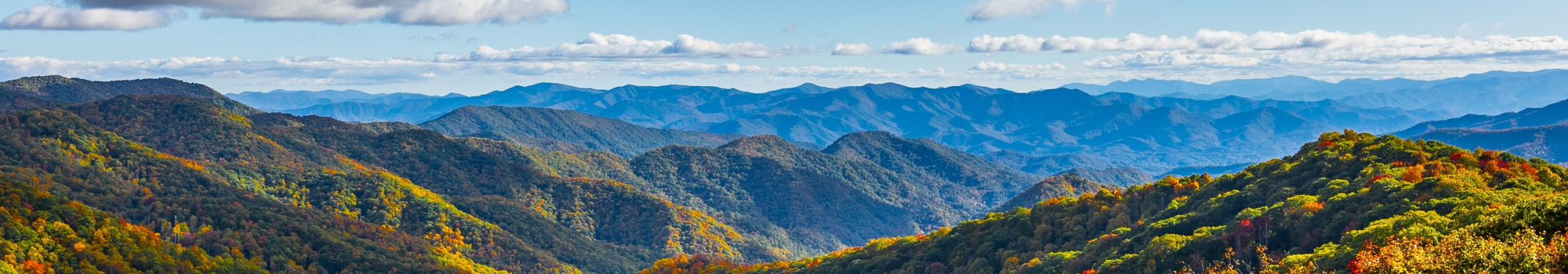
When the weather gets cooler and the trees lose their leaves, it’s even easier to admire the mountain views. One of the peaks you’ll see is Thunderhead Mountain, one of the tallest peaks at 5,527 feet high! You can also catch a glimpse of Gregory Bald at 4,949 feet high!
Connector Trails in Cades Cove
Hiking around Cades Cove is easily an all-day experience, especially when you take advantage of the connector trails like Hatcher Mountain Trail! In addition to intersecting with the Cooper Road Trail, it also connects with the Little Bottoms Trail, the Hannah Mountain Trail, and the Abrams Creek Trail. Other hikes that connect along this route in Cades Cove include the Wet Bottom Trail, the Beard Cane Trail, and the Ace Gap Trail.
We hope you enjoyed learning more about the Hatcher Mountain Trail. Expand your knowledge of the area even more and explore more Cades Cove trails!