
Planning Your Hike in the Smokies
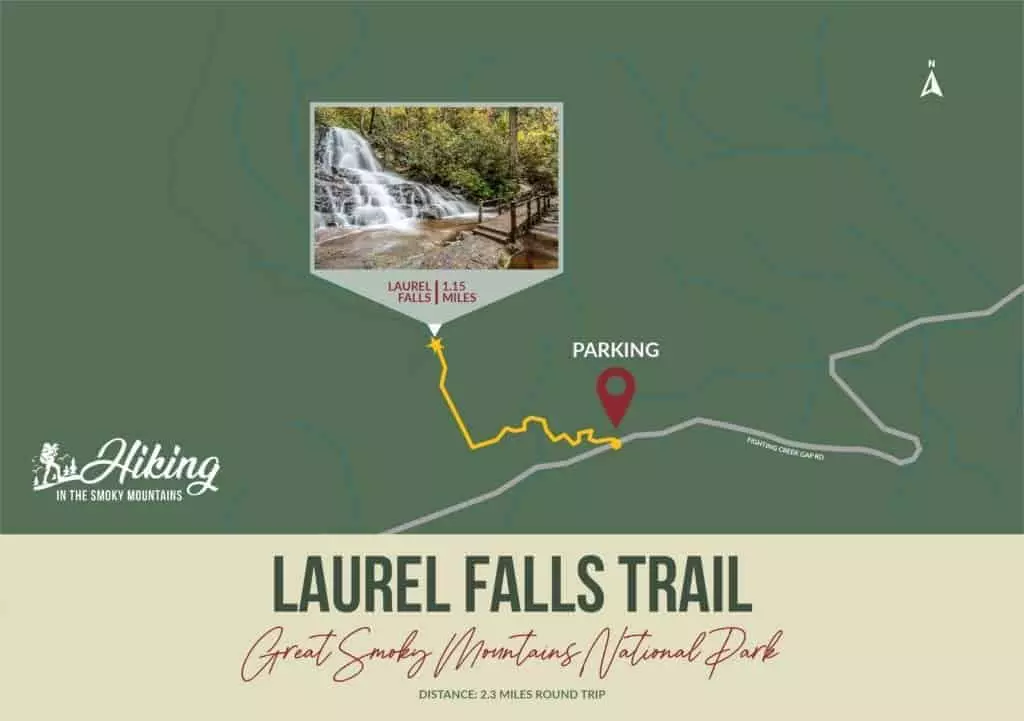
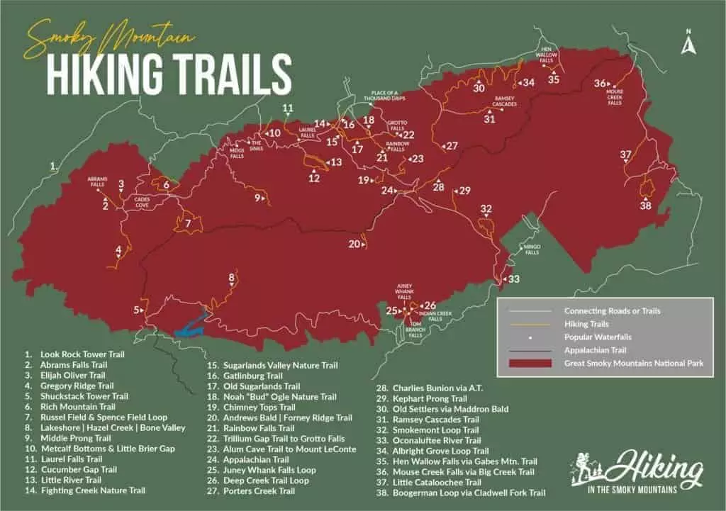
Have you ever wanted to go hiking in the Smoky Mountains but weren’t sure where to go or which trail to use? Our Great Smoky Mountains National Park hiking map can help you decide! Use this detailed map to get an idea of what area the trails are located in, where they begin, and where they end. In addition to the Smoky Mountain hiking trails, the map points out connecting roads, trails, and popular waterfalls. We’ve also included individual Smoky Mountain trail maps for some of the most popular hikes, including the Alum Cave Trail, the Gatlinburg Trail, the Laurel Falls Trail, and the Rainbow Falls Trail. These range in difficulty from easy, flat trails to more difficult, steep hikes, so there’s something for everyone — one of the best things about hiking in Great Smoky Mountains National Park!
Take a look at all our Smoky Mountain hiking maps below:
See Mapsarrow_outward