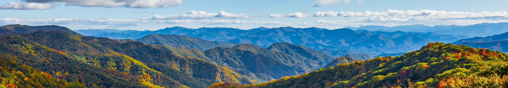
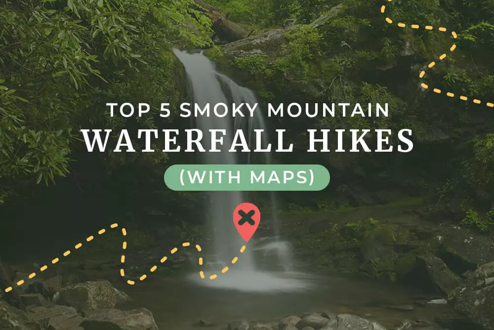
You want to explore the Great Smoky Mountains National Park and find some of the most gorgeous waterfalls while you’re here. There are plenty of falls to see, but how do you decide which ones should be at the top of your list? We’ve put together the top Smoky Mountain waterfall hikes you need to go on, and provided you with maps too!
1. Grotto Falls
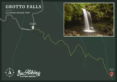
Grotto Falls is one of the most unique waterfalls in the Smokies. It stands at 25 feet, but it is the only waterfall in the Great Smoky Mountains you can actually walk behind! The trail to get to Grotto Falls is considered moderate, and it typically takes about 2 or 3 hours to complete the out and back trip. There are beautiful views of the river along the hike to get to the falls, and you’ll have a great time exploring this trail!
2. Laurel Falls
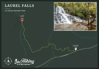
The most popular Smoky Mountain waterfall hike in the park is Laurel Falls Trail. The path to the falls is paved the entire way, making it much easier to navigate. You won’t have to worry about rocks or tree roots making you stumble! This trail is considered easy at 2.6 miles round trip, and as you hike to the top, you can look out at mountain views in the distance. In the spring, you’ll even get to see the mountain laurel the waterfall is named after! Once you get to the end of the trail, you’ll see Laurel Falls standing at 80 feet with 2 tiers of gushing water pouring over the rocks!
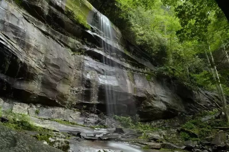
3. Rainbow Falls
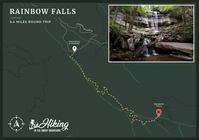
Another moderate trail that will take you to one of the most beautiful waterfalls in the Smoky Mountains is Rainbow Falls Trail. This hike is considered moderate and has a round trip length of 5.4 miles. The trail starts out in a rocky boulder field, so you’ll want to use caution as you continue along the hike. The path follows along LeConte Creek, so you’ll have beautiful views as you make your way up the mountain, and you’ll even cross the creek! Once you’re at Rainbow Falls, you’ll see it standing at 80 feet tall. This waterfall is the tallest single drop falls in the park, and it gets its name from the way light refracts off the water in the afternoon!
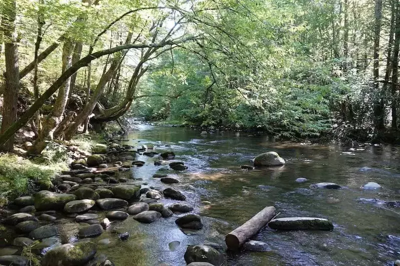
4. Abrams Falls
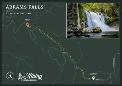
If you happen to be visiting Cades Cove and also want to see another beautiful waterfall, you should hike to Abrams Falls! The trailhead to this hike is about halfway through the loop, near the Visitor Center. The trail itself is considered easy to moderate depending on your skill level. You’ll hike through old forest growth with massive trees surrounding you, until you reach Abrams Creek. After following the creek, you’ll come up on Abrams Falls!
5. Baskins Creek Falls
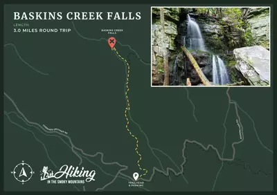
Baskins Creek Falls isn’t one of the more talked about Smoky Mountain waterfalls, but it is arguably one of the most picturesque! To get to the falls, you’ll start out with an easy climb and mountain views, then quickly descend down the mountain, following along the creek. The last 50 yards to the falls is slightly rocky, so be cautious in this area. Baskins Creek Falls is 40 feet tall and is surrounded by beautiful moss covered rock.
These Smoky Mountain waterfall hikes are a great way to spend time in the national park! If you want even more hikes to explore, check out our other Smoky Mountain hiking trails and maps!